
Walks in the Westport area, northern West Coast New Zealand.


About
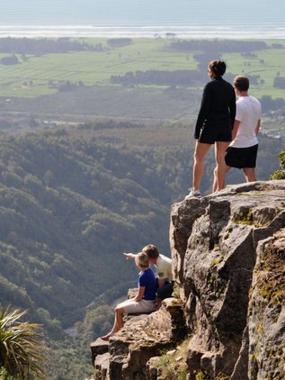
Seal Colony and Cape Foulwind walkway
Time: 10 minutes or 1 hr 30 minutes.
Skill level: Easy.
An easy walk from the Tauranga Bay car park leads to viewing platforms overlooking the seal colony. The track continues above the coastline to the historic Cape Foulwind lighthouse.
- Find out more about the seal colony and Cape Foulwind walkway.
Constant and Joyce Bays
Time: 15 minutes.
Skill level: Easy.
Coastal rock formations and sea views. The Constant Bay Loop takes around 15 minutes. It provides a great view of the rugged west coast, with waves smashing over rocks and cliffs surrounding you. While this track is great for families there are exposed sections with drops, and children should be supervised.
Getting there:
Charleston is 33 km north of Punakaiki and 26 km south of Westport on SH6.
The track starts from the Constant Bay carpark, Charleston.
Know before you go:
- The area around Constant Bay is very exposed to weather, so dress appropriately.
- There are drops next to the walking track, and possibility of stray waves.
- A climber’s access track attaches to the Constant Bay Loop. It is not maintained, with many big drops. This track should not be used without appropriate experience.
Denniston Bridle Path walk
Time: 3 hours up, 2 hours down.
Skill level: Moderate.
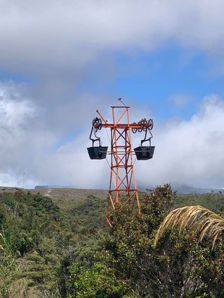
Sign posted from Conns Creek Road between Waimangaroa, this historic bridal track used by coalminers makes a pleasant, if steep, bush walk. A short branch track near the top leads to the incline that carried coal down (and occasional cool-nerved passengers up). A lower branch to the Waimangaroa-Denniston road offers a shorter walking option.
Getting there:
Denniston is 18 km northeast of Westport. From Westport, follow SH67 north for 15 km. Turn right at Waimangaroa onto the road to Denniston.
The bottom of the track is signposted on Conns Creek Road behind Waimangaroa, the top end is signposted in Denniston township.
Know before you go:
Sections of the track involve creeks crossings, slippery rocks and a narrow track on a steep slope.
Creeks are subject to sudden high flows.
Suitable footwear, experience and care is required.
Before you go into the outdoors, tell someone your plans and leave a date to raise the alarm if you haven't returned. To do this, use the New Zealand Outdoors Intentions process (external site) on the AdventureSmart website. It is endorsed by New Zealand's search and rescue agencies and provides three simple options to tell someone you trust the details about your trip.
History and culture:
Aside from the incline, which was used for the transportation of coal, the bridle path, completed in 1884, was the only means of access to Denniston. Travel along this route was either by horse, or on foot.
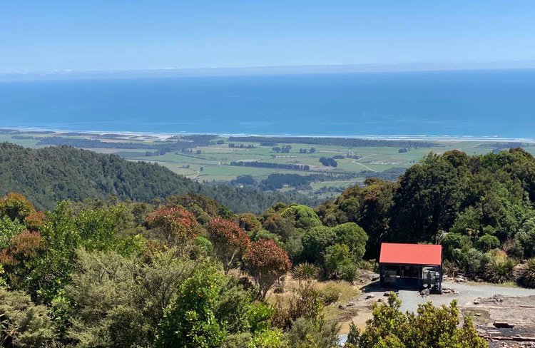
Denniston town walk
Time: 40 minutes.
Skill level: Easy
Take a historic walk on the same tracks that residents and miners used over a hundred years ago in the coal mining township, and explore the many relics still present. From Friends of the Hill Museum on the Denniston Plateau this walk takes you via the old historic sites of Denniston Township.
Interpretation panels alongside the tracks bring the history of the Denniston township to life.
Brakehead Walk
Time: 40 min loop
Distance: 1.1 km
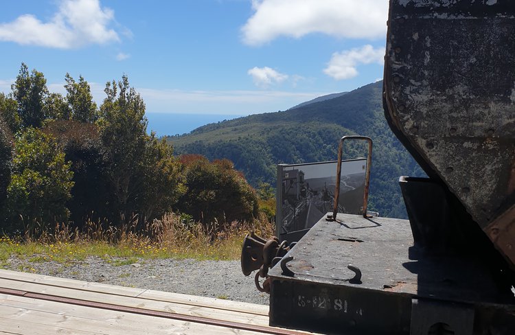
Starting from the car park above the Brakehead, this walk leads to a viewpoint at the top of the famous Denniston incline, past Denniston’s first settlement ‘The Camp’ and on to the Banbury Arch (a drystone arch) viewpoint. It returns via the historic mine workshop site. You can see many relics from Denniston’s past on this walk.
Coalbrookdale Walk
Time: 1 hr return
Distance: 2 km
A good gravel road behind Denniston (still used by coal trucks) leads to the start of the walkway that follows part of the cable-car rope road that carried coal from the mines to the top of the Denniston Incline. Relics include tunnels, foundations, a haulage winch and the country's best remaining example of a mine fanhouse.
Britannia Track
Time: 4 hr return
Distance: 12 km
In an area rich in history, this walk follows an old pack track climbing steadily through varied forest of rātā, rimu and kahikatea to the abandoned Britannia gold mine. Here you’ll find a complete five-head quartz crushing battery with most of its ancillary equipment intact.
To get to the track, travel 3 km north of Waimangaroa, turn off State Highway 67 on to O’Connor Road, and follow this road for 5 km to the car park and start of the track.
Getting there
Denniston is 18 km northeast of Westport. From Westport, follow SH67 north for 15 km. Turn right at Waimangaroa onto the road to Denniston.
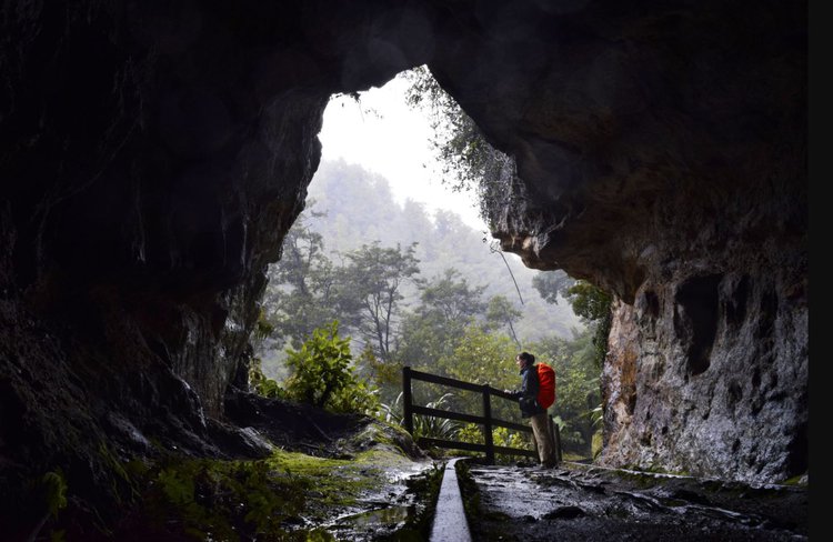
Charming Creek walkway
Time: 6 hours one way
Skill level: Easy.
The first 30 minutes of this walks from the Ngakawau end provides a delightful walk along a siding used to shunt timber and coal to Ngakawau Railway.
35 km north-east of Westport.
More information on West Coast walks
For more information on West Coast Walks please visit:
Location
Westport, New ZealandRelated listings

Habitat Sports and Cycles
Track Shuttle services, Bikes & Hire, Fishing & Hunting, Camping & Hiking, Food & Nutrition plus more!
Learn more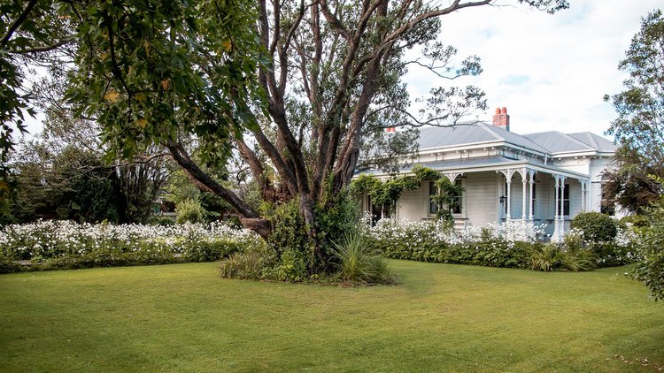
Archer House
Exclusive Westport accommodation, Archer House is a boutique bed and breakfast guest house, ideal for holiday accommodation.
Learn more

Sounds Air Travel & Tourism Ltd
Where can we take you? Wellington - Napier - Blenheim - Paraparaumu - Picton - Nelson - Westport - Taupo
Learn more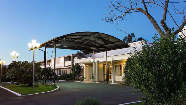
Westport Motor Hotel
The Westport Motor Hotel is a leading accommodation provider in Westport with 27 studio units, onsite restaurant and bar.
Learn more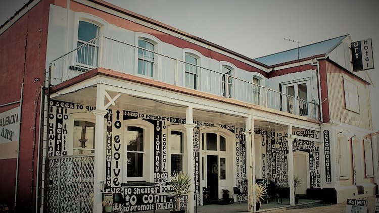
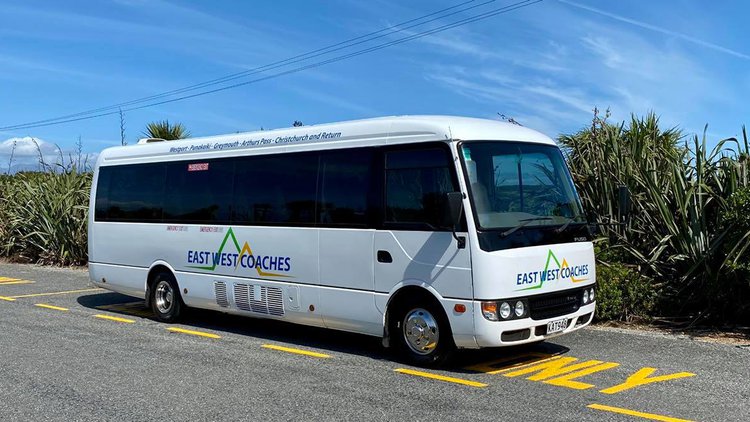
East West Coaches
Reliable, Premium shuttle service, Operating successfully out of the Westport for over 25 years
Owned and operated by a local friendly professional team
Westport to Christchurch and return, Sunday – Friday
